



Related Products
Depth 100m/150m/300m
Measuring time 6-8min
Measurement data unit electric field component of different frequencies of the earth electromagnetic field ΔVs (mV)
Maximum Channels: 18
Display screen unit: 10.1-inch HD touch screen (1024 *600)
A/D conversion: 16-bits 1Msps
Minimum resolution: 0.001mv
Point selection: 1-18 points optional
Power consumption: about 9W
Working environment temperature: -20°C ~ +50°C
Controller : 32-bit high speed CPU
Standby time: 8h
Cable: 2.5m point pitch, 10m line pitch 54.7m in total length
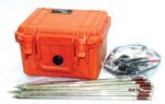
Electrode: Each comes standard with 22pcs
Host Weight: 1.95kg
• High Measurement Accuracy: It delivers reliable resistivity readings with excellent anti-interference performance, even in complex geological conditions.
• Automatic Data Processing: It is integrated with intelligent system for real-time data analysis, curve plotting, and geological profiling without the need for external computers.
• User-Friendly Operation: It has one-touch control and clear LCD interface simplify field operations, reducing survey time and improving productivity.
• Powerful Performance: It is capable of high-voltage and long-distance measurements, enabling deep exploration up to several hundred meters.
• Durable & Portable Design: Rugged construction and compact build for easy transport and dependable use in diverse environments.
• Proton-precession sensor for absolute total-field measurements
• Rugged, weather-resistant housing for field durability
• Large, readable display with clear numeric and status indicators
• Onboard memory for thousands of readings and time-stamped records
• GPS time/position tagging (optional) and USB/Bluetooth data transfer
• Long-lasting rechargeable battery with field-replaceable pack
Lightweight carry case and mounted tripod/stand options
• 8-channel simultaneous measurement for rapid data acquisition
• Wi-Fi enabled for seamless remote control and data transfer
• Expandable electrode capacity – supports up to 112 electrodes with 5m spacing
• Marine and land survey compatibility, ideal for complex terrains and aquatic environments
• Integrated GPS and EarthImager™ software for precise positioning and advanced inversion modeling
• Rugged field-ready design with heavy-duty transport case, stainless steel electrodes, and robust cabling