
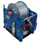

DJ SERIES LOGGING WINCH II

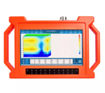
Original price was: KShs 5,600.00.KShs 5,500.00Current price is: KShs 5,500.00.
Related Products

Product Features:
- Be suitable for plain, hill, mountain land, highland, basin all kinds of geologic structure application;
- Automatic mapping in the instrument, get drilling position and depth result at site.
- Professional user group offers 24 hours after sale service.
- The average accuracy of more than 90% from user’s feedback.
- Four languages including English/Spanish/French/Arabic are optional.
- It is widely used for drinking water, agricultural irrigation water detection.
- Non-professionals can learn the operation way in 5 minutes.
- only 1-2 people can operate.
- Two years warranty.

Product Features:
- No need to register
- No need network, no need traffic
- Automatically draw geological profile map
- Suitable for various terrain exploration
- Expert remote assistance to find location
- No experience person can operate in 5 minutes
- Two years warranty

Product Features:
- No need to register
- No need network, no need traffic
- Automatically draw geological profile map
- Suitable for various terrain exploration
- Expert remote assistance to find location
- No experience person can operate in 5 minutes
- Two years warranty.

Product Features:
- Be suitable for plain, hill, mountain land, highland, basin all kinds of geologic structure application;
- Automatic mapping in the instrument, get drilling position and depth result at site.
- Professional user group offers 24 hours after sale service.
- The average accuracy of more than 90% from user’s feedback.
- Four languages including English/Spanish/French/Arabic are optional.
- It is widely used for drinking water, agricultural irrigation water detection.
- Non-professionals can learn the operation way in 5 minutes.
- only 1-2 people can operate.
- Two years warranty.
- Selected the depth according to your demand,150 / 300 / 500 / 600 Meters

Product Features:
- Be suitable for plain, hill, mountain land, highland, basin all kinds of geologic structure application;
- Automatic mapping in the instrument, get drilling position and depth result at site.
- Professional user group offers 24 hours after sale service.
- The average accuracy of more than 90% from user’s feedback.
- Four languages including English/Spanish/French/Arabic are optional.
- It is widely used for drinking water, agricultural irrigation water detection.
- Non-professionals can learn the operation way in 5 minutes.
- only 1-2 people can operate.
- Two years warranty.
- Selected the depth according to your demand, 100/150 / 300 / 500 Meters

Product Features:
- Be suitable for plain, hill, mountain land, highland, basin all kinds of geologic structure application;
- Automatic mapping in the instrument, get drilling position and depth result at site.
- Professional user group offers 24 hours after sale service.
- The average accuracy of more than 90% from user’s feedback.
- Four languages including English/Spanish/French/Arabic are optional.
- It is widely used for drinking water, agricultural irrigation water detection.
- Non-professionals can learn the operation way in 5 minutes.
- only 1-2 people can operate.
- Two years warranty.
- Selected the depth according to your demand, 100/150 / 300 Meters

Product Features:
- Be suitable for plain, hill, mountain land, highland, basin all kinds of geologic structure application;
- Automatic mapping in the instrument, get drilling position and depth result at site.
- Professional user group offers 24 hours after sale service.
- The average accuracy of more than 90% from user’s feedback.
- Four languages including English/Spanish/French/Arabic are optional.
- It is widely used for drinking water, agricultural irrigation water detection.
- Non-professionals can learn the operation way in 5 minutes.
- only 1-2 people can operate.
- Two years warranty.
- The models combines of 100M/ 150M

Product Features:
- Automatic analysis: The instrument analyzes the abnormal area with one click.
- Automatic mapping: Automatically draw curve map, profile map, and 3D renderings.
- Stable and reliable: Collect 18 points data with one-time wiring.
- Increment function: The extension of geological structure can be analyzed by making supplementary measurement in front and rear of the survey line.
- Data storage: It can store curve map, profile map, and 3D renderings of more than 999 survey lines to facilitate the production of geophysical exploration reports.
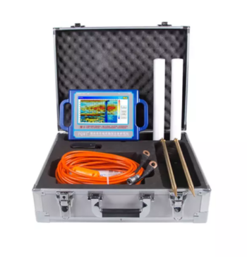
Depth 100 / 150 / 300 / 500 Meters
Frequency Single, Triple, 36/40/56frequency
Channel 8
System PQWT
LCD Industrial 7-inch HD touch screen
Units of Measurement △Vs(mV)
Measurement Range 0mV-2000mV
Stand-by Time 8-10 hours
Power Supply Battery Model #26650; 3.7V 4000mAh Rechargeable lithium battery

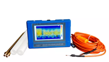
Depth: 150 Meters
Frequency: Single, Triple, 33frequency
Channel: 4
System: PQWT
LCD: Industrial 7-inch HD touch screen
Units of Measurement: △Vs(mV)
Measurement Range: 0mV-1000mV
Stand-by Time: 8-10 hours
Power Supply: Battery Model #26650; 3.7V 4000mAh Rechargeable lithium battery

Product Features:
- Be suitable for plain, hill, mountain land, highland, basin all kinds of geologic structure application;
- Automatic mapping in the instrument, get drilling position and depth result at site.
- Professional user group offers 24 hours after sale service.
- The average accuracy of more than 90% from user’s feedback.
- Four languages including English/Spanish/French/Arabic are optional.
- It is widely used for drinking water, agricultural irrigation water detection.
- Non-professionals can learn the operation way in 5 minutes.
- only 1-2 people can operate.
- Two years warranty.